Module 2: How GIS works
2.5 Mapping the real world
 |
Modelling
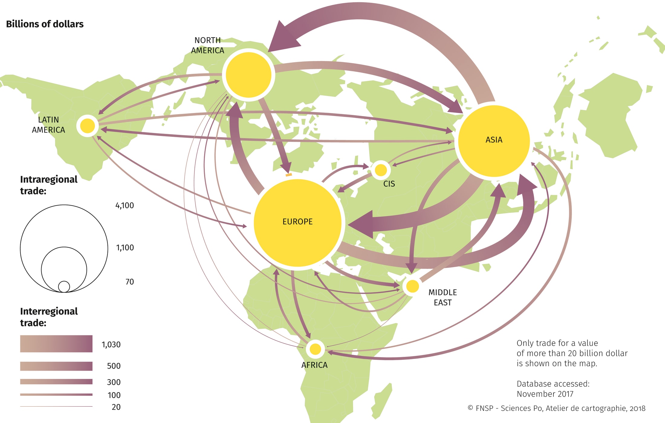
Modelling A model is always a simplified representation of reality. Accordingly, the task of cartographic modelling is to focus on model-relevant aspects of reality (geoinformation). It is possible to limit the entire image (geo-space) using various variables, the limitations of which can also act in parallel: 3. Time limit: Cartographic representation of a specific state or time interval. A reduction or abstraction is essential for a cartographic model. A representation of the world with an analysis of global trade relations and the global division of labour should serve as an example. A depiction of the earth on a scale of 1:1 would come close to reality, but would not be very clear. Trade relations over large distances could neither be captured nor depicted. A 1:1 scale image of the Earth is therefore not suitable for analysing and answering global questions, which is why a scale-based reduction is essential for thematic reduction (trade relations) (see Figure 2.5.1). 
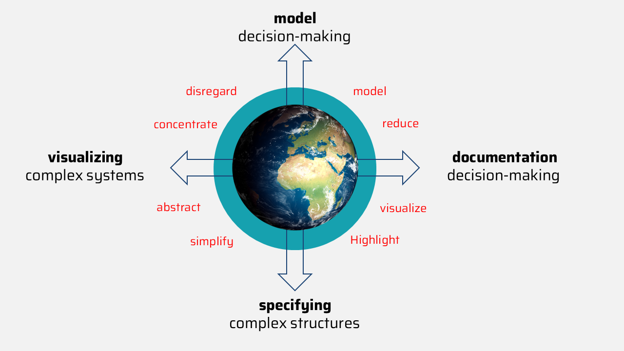
Illustration 2.5.1: Global trade relations (Quelle: FNSP - Sciences Pro, Atelier de cartographie 2018). Consequently, a model does not capture all the information of the original, but only that which is of interest. Although this is always accompanied by a loss of information, it is precisely the strength of models to focus on certain facts and present them clearly. This goes hand in hand with pragmatism in that when creating the model, the question is asked for what reason (why?), for what purpose (what for?) and for which person or group (for whom?) the model is being created. Only by answering these questions can a model be grasped and deconstructed. In this way, modelling aims to focus on a specific issue (specification) and to store the information (documentation) so that the issue can be clearly presented (visualisation) and presented for decision-making (template) (see Figure 2.5.2). 
Figure 2.5.2: Objectives of modelling (own illustration). |
 |
The geo objectZur Datenverarbeitung sind zunächst Methoden zur Datengewinnung nötig. Dies sind klassische Vermessungen und Kartierungen. The layer principleZur Datenverarbeitung sind zunächst Methoden zur Datengewinnung nötig. Dies sind klassische Vermessungen und Kartierungen. |
 |
Interactive taskJon Snow has forgotten where he collected his data. Can you remember and help him?
|
